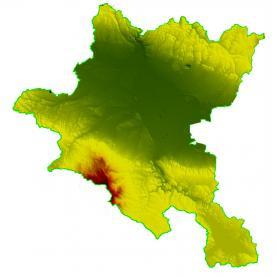
Generating a digital terrain model
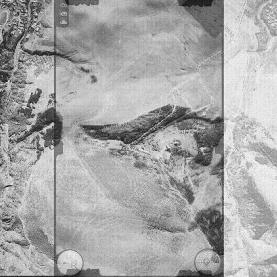
Processing aerophoto and satellite imagery
Photographing the Earth's surface is the fastest and most modern way to update geographical information.
Digital photogrammetry works with digital images obtained from digital metric cameras or scanning images from analog cameras. Applying the methods of digital photogrammetry, raster images are processed - aerial images (made from an aircraft) and/or satellite images.
Planning and preparation to capture a particular site depends on the purpose and objectives of the project. Particular technical means are selected to determine the parameters of capturing, a plan for the flight is created, control points of the field are chosen and marked, and they provide a link between the ground and the image.
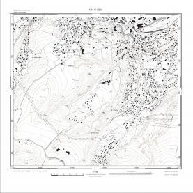
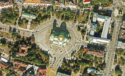
After photographing is completed, there are various processes to follow, the most important of which are: aero-triangulation (condensing a spaced-out grid and coordinating it); generating a digital model of the terrain; building a mosaic of orthorectified and georeferenced images – an ORTHOPHOTOPLAN. The orthophotoplan combines the graphic accuracy of a map and the information content of a photograph.
Photogrammetric image processing is performed using specialized software - PHOTOMOD, developed by the Russian company Racurs Co, whose sole representative for Bulgaria is GIS-Sofia Ltd.
In the database of GIS-Sofia are stored orthophotoplans covering the territory of Sofia Municipality with aero- and satellite images from the following years:
- Aerial photography with a digital camera (pixel size on the terrain 10 cm for residential territories, 15 cm – for non-residential territories) - year 2020.
- Satellite images WorldView 3 (resolution of 0.3 m) - 2017.
- Satellite images WorldView 2 (resolution of 0.5 m) and WorldView 3 (resolution of 0.3 m) - 2015.
- Satellite images GeoEye-1 (resolution of 0.5 m) – year 2013.
- Aerial photography with a digital camera (pixel size on the terrain 10 cm) - year 2011.
- Aerial photography with a digital camera (pixel size on the terrain 10 cm for residential territories, 20 cm – for non-residential territories) - year 2008.
- Satellite images QuickBird (resolution of 0.6 m) – years 2007-2008.
- Aerial photographing with an analog camera (pixel size on the terrain 10 cm) - year 2006.
- Satellite images IKONOS (resolution of 1.0 m) - year 2005.
- Satellite images QuickBird (resolution of 0.6 m) - year 2003.
- Satellite images IKONOS (resolution of 1.0 m) – years 2000-2002.
Services of the same category